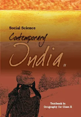
Social ScienceClass 10

Contemporary India II

Geography7 Chapters

Chapter notes

What you'll learn in Contemporary India II

A quick revision map of Contemporary India II — the core idea and five key takeaways from each chapter. Tap any chapter to read the full NCERT PDF and detailed notes.

01

Resources and Development

Chapter 6 of NCERT Class 10 Geography (Contemporary India II), "Resources and Development", explores how everything available in our environment that is technologically accessible, economically feasible, and culturally acceptable becomes a resource through human interaction with technology and institutions.

  • 1Resources classified by origin (biotic/abiotic), exhaustibility (renewable/non-renewable), ownership (individual/community/national/international), and development status
  • 2Resource planning identifies, inventories, and matches resource development with technology, skill, and institutional capacity
  • 3Alluvial soils dominate northern plains; black soils cover Deccan plateau suited for cotton; laterite soils develop under tropical climate with intense leaching
  • 4Land use in India: net sown area 45.64%, forests 23.41%, permanent pastures 5.40%, other categories for non-agricultural use
  • 5Soil erosion caused by human activities (deforestation, overgrazing, mining, defective farming) and natural forces (water, wind, glaciers)
02

Forest and Wildlife Resources

Chapter 7 of NCERT Class 10 Geography, 'Forest and Wildlife Resources', covers India's rich biological diversity, categories of forests (reserved, protected, and unclassed), endangered species protection through conservation projects like Project Tiger, and community-led conservation strategies including sacred groves and joint forest management.

  • 1Biodiversity—diverse flora and fauna closely integrated in ecological systems supporting human survival
  • 2Indian Wildlife Protection Act (1972)—legal framework protecting endangered species and habitats
  • 3Project Tiger (1973)—major conservation campaign saving tigers from estimated 1,827 to current populations
  • 4Forest classification—reserved forests (most valuable, >50% total), protected forests (~1/3 total), unclassed forests
  • 5Sacred Groves—virgin forests preserved by tribal beliefs, untouched by local communities
03

Water Resources

Chapter 8 of NCERT Class 10 Geography, "Water Resources", explores water scarcity causes, multi-purpose river projects, and rainwater harvesting as sustainable water conservation methods.

  • 1Water scarcity caused by over-exploitation, excessive use, and unequal access—not just low rainfall
  • 2Multi-purpose river projects: dams for irrigation, hydroelectric power, flood control, and water supply
  • 3Environmental consequences of dams: poor sediment flow, aquatic habitat fragmentation, sedimentation of reservoirs
  • 4Rainwater harvesting methods: rooftop collection, underground tankas, khadins and johads, bamboo drip irrigation
  • 5Inter-state water disputes: Krishna-Godavari case over Maharashtra's Koyna diversion
04

Agriculture

Chapter 4 of NCERT Class 10 Geography, "Agriculture", explores India's agricultural practices, types of farming systems, cropping patterns across three seasons (rabi, kharif, zaid), and major crops grown under different climatic and soil conditions. The chapter also covers technological and institutional reforms that transformed Indian agriculture, including the Green Revolution and land reforms.

  • 1Primitive subsistence farming: slash-and-burn agriculture (jhumming) practiced in North-east India
  • 2Intensive subsistence farming: labour-intensive, high chemical inputs, found in high population pressure areas
  • 3Commercial farming: uses HYV seeds, fertilizers, pesticides; degree varies by region
  • 4Three cropping seasons: rabi (winter, October-June), kharif (monsoon, June-September), zaid (summer)
  • 5Major crops: rice (staple, kharif), wheat (rabi), millets, pulses, sugarcane, oilseeds, tea, coffee, cotton, jute
05

Minerals and Energy Resources

Chapter 5 of NCERT Class 10 Geography, "Minerals and Energy Resources", covers the classification of minerals by type and mode of occurrence, India's distribution of major mineral deposits, conventional and non-conventional energy sources, and the importance of conservation in sustainable resource management.

  • 1Ferrous vs non-ferrous minerals: classification by metal content
  • 2Five modes of mineral occurrence: veins/lodes, sedimentary beds, residual deposits, placer deposits, ocean water
  • 3Major ferrous minerals: iron ore (magnetite, hematite), manganese
  • 4Major non-ferrous minerals: copper, bauxite, lead, zinc, gold
  • 5Non-metallic minerals: mica, limestone
06

Manufacturing Industries

Chapter 6 of NCERT Class 10 Geography, "Manufacturing Industries", explores how production transforms raw materials into finished goods through industrial processes, classifies industries by raw materials and ownership, examines major Indian industries including textiles, iron and steel, and discusses industrial pollution control measures.

  • 1Manufacturing is processing raw materials into valuable finished products
  • 2Industries classified by raw materials, ownership structure, and capital investment
  • 3Agro-based industries: textiles, sugar, edible oil from agricultural raw materials
  • 4Mineral-based industries: iron and steel, cement, aluminum from mineral sources
  • 5Industrial pollution includes air, water, land, and noise pollution requiring control measures
07

Life Lines of National Economy

Chapter 12 of NCERT Class 10 Geography, "Life Lines of National Economy", explains how transport, communication, and trade serve as the vital networks linking India's economy. These lifelines enable the movement of goods and services across land, water, and air, and connect India to global markets.

  • 1Roadways: India's second largest road network (62.16 lakh km); includes Golden Quadrilateral Super Highways connecting Delhi-Kolkata-Chennai-Mumbai
  • 2Railways: Principal mode of transport; 67,956 km network across 17 zones; major integration force for 150+ years
  • 3Waterways: 111 National Waterways; 14,500 km inland navigation; 95% of foreign trade volume by sea from 12 major ports
  • 4Airways: Fastest mode connecting difficult terrains and remote regions; UDAN scheme promotes regional connectivity
  • 5Pipelines: Transport crude oil, petroleum products, and natural gas; network expanded from 1,700 km to 18,500 km

More Social Science books

Want offline access with notes & solutions?

Download CBSE Prepmaster for free — includes NCERT solutions, flashcards, mock tests & more.

Download Free App